In less than a day, Beryl went from an area of interest to the first hurricane of the 2018 Atlantic hurricane season.
This tiny hurricane may strengthen a tad more into the weekend.
It will eventually encounter increasing wind shear and weaken, but that may not occur until early next week.
Thus, it's increasingly possible Beryl may impact the Lesser Antilles as a hurricane.
Beryl may survive as a tropical cyclone into the central Caribbean early next week.
Hurricane Beryl, while tiny in size, will approach the Lesser Antilles late this weekend or early next week, and its chances of striking the Antilles as a hurricane are increasing.
A hurricane watch has been issued for the island of Dominica and hurricane conditions are possible late Sunday or on Monday.
Tropical storm watches have been issued for Martinique, Guadeloupe, St. Martin and St. Barthelemy. Winds over those islands may reach 40 mph late Sunday or on Monday.
Current Tropical Storm Watches and Warnings
(MORE: What to Expect in the Atlantic During July)
This tiny hurricane is currently located over 850 miles east-southeast of the Windward Islands, moving westward.
Current Storm Status
(The highest cloud tops, corresponding to the most vigorous convection, are shown in the brightest red colors. Clustering, deep convection around the center is a sign of a healthy tropical cyclone.)
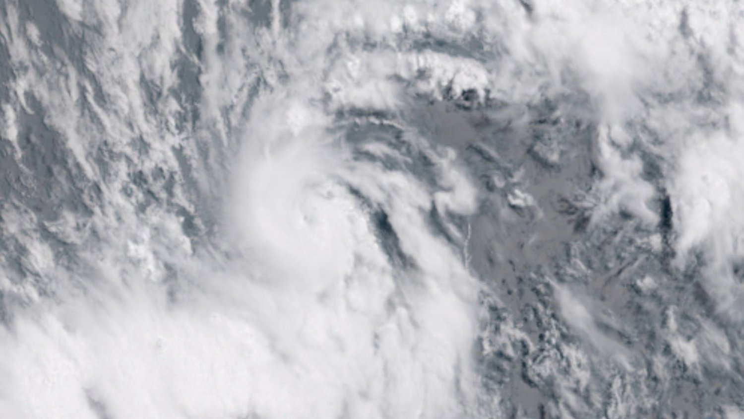
Beryl was upgraded to a hurricane based on microwave and infrared satellite imageryshowing a "pinhole eye" had developed early Friday morning. Beryl's eye has recently closed off, and some dry air may have gotten into Beryl's core.
Its tropical storm-force winds extend only up to about 35 miles from its center.
Beryl's Current Wind Field
(The orange circle shows the extent of the system's tropical storm-force winds (at least 39 mph). The purple circle indicates the extent of hurricane-force winds (at least 74 mph), according to the National Hurricane Center.)
Intensity forecasts with tropical cyclones as tiny as Beryl are notoriously difficult.
Given barely enough ocean heat content (sea-surface temperatures around 80 degrees Fahrenheit), low wind shear, and its location south of a plume of sinking, dry air known as the Saharan air layer, Beryl intensified quickly from a tropical depression at 11 a.m. EDT Thursday to a Category 1 hurricane just 18 hours later.
According to the National Hurricane Center (NHC), these favorable conditions may remain in place through early Sunday, and Beryl could gain even more intensity.
By late Sunday, upper-level winds are expected to become hostile to Beryl near the Lesser Antilles.
If the wind shear kicks in later, Beryl could survive as a hurricane into the Caribbean.
If the wind shear kicks in earlier, Beryl may weaken sooner, and may sweep into the islands as a weaker storm.
A hurricane hunter mission is scheduled to investigate Beryl and its surroundings early Sunday. We'll know a lot more about this system if this flight goes on as scheduled.
Current Satellite and Wind Shear
(The current tropical system is shown by the icon at lower right. Areas of strong wind shear, the difference in wind speed and direction with height, are shown in purple. High wind shear is hostile to tropical cyclones and those trying to develop.)
Beryl's impacts will begin to reach the Lesser Antilles late Sunday or Monday.
Given Beryl's tiny size, it's too soon to determine which islands may see impacts and how strong the impacts will be, but periods of heavy rain, gusty winds and at least some locally choppy seas can be expected, regardless.
Several inches of rainfall are likely nearest where Beryl cuts through the northern Windward or southern Leeward Islands. This area of heavy rainfall will be fairly confined to a narrow zone along Beryl's path.
Projected Path
(The red-shaded area denotes the potential path of the center of the tropical cyclone. It's important to note that impacts (particularly heavy rain, high surf, coastal flooding, winds) with any tropical cyclone usually spread beyond its forecast path.)
There is now the chance Beryl may survive in some form into the central Caribbean Sea early next week, though it is expected to have been weakened to some degree, possibly completely ripped apart, from wind shear by that time.
Those in the Lesser Antilles, Virgin Islands, Puerto Rico, the Dominican Republic and Haiti should monitor the progress of Beryl. We'll have the latest updates on weather.com.
The formation and intensification of a system in the central tropical Atlantic, known as the Main Development Region (MDR), in early July is fairly rare.
In fact, it's only one of two such hurricanes to form this early in the season east of the Lesser Antilles.
Tropical waves, the origin of many late summer and early fall hurricanes and the predecessor disturbance for Beryl, typically don't have enough moisture in July to become better developed.
The name 'Beryl' has been used 6 times since 1982, each time as a tropical storm. This iteration of Beryl is the first one to become a hurricane.
Historical tracks and intensities of former Beryls.
The average second tropical storm is on Aug. 1 while the average first hurricane doesn't occur until Aug. 10. Beryl formed on Jul. 5 and became a hurricane a day later.


Comments
No comments on this item Please log in to comment by clicking here