Potentially catastrophic flooding, and destructive winds approaching
From weather.com
Florence remains a dangerous Category 4 hurricane.
A strike on the Carolinas will occur late Thursday and into Friday.
Hurricane and storm surge warnings have been issued.
A life-threatening storm surge is expected with landfall.
Catastrophic inland flash flooding and major river flooding may result.
Tropical-storm-force winds may arrive as soon as Thursday morning.
Florence is also generating dangerous surf and rip currents along the East Coast.
Hurricane Florence will lash the Carolinas and Virginia late Thursday and into Friday as an intense hurricane with life-threatening storm surge, destructive winds, and potentially catastrophic inland rainfall flooding as one of the strongest strikes on record for this part of the U.S. East Coast.
A hurricane warning and storm surge warning are now in effect from the South Santee River, South Carolina northward to Duck, North Carolina, including the Albemarle and Pamlico sounds. This includes Myrtle Beach, South Carolina, Wilmington, North Carolina, and most of the Outer Banks.
Hurricane watches and storm surge watches remain posted north of Duck, North Carolina, to the border between North Carolina and Virginia, as well as from Edisto Beach, South Carolina, northward to the South Santee River. This includes Charleston, South Carolina.
Hurricane watches also extend to some extent inland in the Carolinas, including such cities as Goldsboro and Lumberton, North Carolina, with a hurricane warning posted for Kinston, North Carolina.
Tropical storm watches have been issued farther north from the border between North Carolina and Virginia to Cape Charles Lighthouse, Virginia, as well as for the Chesapeake Bay south of New Point Comfort, Virginia. This includes Virginia Beach and Norfolk, Virginia.
Watches and Warnings
(A watch means hurricane or tropical storm conditions are possible within 48 hours. A warning means those conditions are expected within 36 hours.)
A hurricane warning means hurricane-force winds (74-plus mph) are expected somewhere within the warning area and is typically issued 36 hours ahead of the arrival of tropical-storm-force winds (39-plus mph), which could make last-minute preparations difficult.
A storm surge warning means there is a danger of life-threatening storm-surge inundation within the warning area during the next 36 hours from rising water moving inland from the coastline.
If you're in the East Coast threat zone, it's time to finish up your hurricane preparedness plan and be ready to implement if necessary. Residents in coastal areas should follow evacuation orders from local officials because of the potential for life-threatening storm-surge flooding.
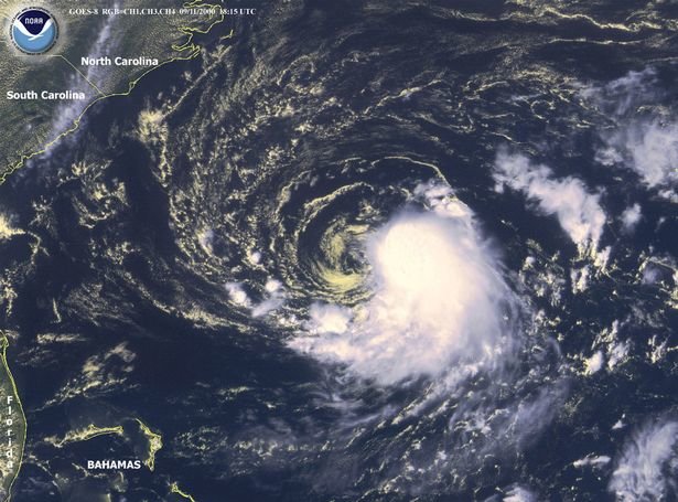
As of late Tuesday afternoon, Florence was centered more than 700 miles east-southeast of Cape Fear, North Carolina, moving west-northwestward.
Current Storm Status
(The highest cloud tops, corresponding to the most vigorous convection, are shown in the brightest red colors. Clustering, deep convection around the center is a sign of a healthy tropical cyclone.)
Florence replaced its eyewall Tuesday morning, something that can happen multiple times in intense hurricanes. During this period, the hurricane may level off or weaken a tad but then gain strength as the outer eyewall contracts inward, replacing the old inner eyewall, leaving a larger core with, most importantly, a larger wind field.
Florence underwent rapid intensification Sunday into Monday when its winds jumped up from 75 mph to 130 mph in just 25 hours ending 12 p.m. EDT Monday.
Some additional strengthening is possible, and it's not out of the question that Florence could approach Category 5 status for a time by Wednesday.
Florence is generating swells that are affecting parts of the U.S. East Coast. Swells are also propagating to Bermuda and north- and northeastward-facing coasts of the Lesser Antilles, Puerto Rico, Hispañiola, the Turks and Caicos and the Bahamas.
These swells will produce life-threatening surf and rip current conditions at these beaches.
Florence is being steered toward the coast of the Carolinas by a strong dome of high pressure aloft over the western Atlantic Ocean.
Projected Path
(The red-shaded area denotes the potential path of the center of the tropical cyclone. It's important to note that impacts (particularly heavy rain, high surf, coastal flooding, winds) with any tropical cyclone usually spread beyond its forecast path.)
There remains some uncertainty where exactly the eye of Florence will make landfall late Thursday or early Friday, which will determine what part of the coastline experiences the worst wind and storm-surge impacts.
The National Hurricane Center is forecasting Florence to be a major hurricane, at least Category 3 intensity, when it arrives at the southeastern U.S. coast late Thursday or early Friday.
However, what happens after landfall is quite uncertain. That dome of high pressure aloft is expected to weaken, which may allow Florence to stall and meander. Here is what we know right now about Florence's track timing. All of this is subject to change slightly, so check back for updates.
- Timing: The peak coastal impacts from Florence are expected late Thursday and into early Friday. Tropical-storm-force winds are expected to first arrive Thursday morning along the southeastern U.S. coast in the general area of the forecast path. Impacts from Florence, particularly heavy rain, may continue into this weekend or early next week if it stalls out or moves erratically for a time, as suggested by forecast guidance.
- Locations Potentially Affected: Areas from the Carolinas to southern Virginia are at greatest risk for major impacts from Florence. Locations farther south, such as Georgia, and farther north into the mid-Atlantic should also monitor Florence for any forecast changes.
- Storm-Surge Impact: A destructive storm surge will accompany the eye coming ashore late Thursday or early Friday. It will be highest to the north or northeast of where the center comes ashore. Large, battering waves will ride atop this surge. All evacuation orders from local officials should be followed because of this dangerous threat. Significant beach erosion is also likely on the southeastern U.S. coast. Elevated water levels may persist for some time after landfall in areas where onshore winds persist.
Storm Surge Watches and Warnings
Here are the latest storm-surge inundation forecasts from the National Hurricane Center if the eye of Florence arrives at high tide:
- Cape Fear, North Carolina, to Cape Lookout, North Carolina, including the Neuse and Pamlico rivers: 9 to 13 feet
- North Myrtle Beach, South Carolina, to Cape Fear, North Carolina: 6 to 9 feet
- Cape Lookout to Ocracoke Inlet, North Carolina: 6 to 9 feet
- South Santee River, South Carolina, to North Myrtle Beach, South Carolina: 4 to 6 feet
- Ocracoke Inlet, North Carolina, to the North Carolina/Virginia border: 4 to 6 feet
- Edisto Beach to the South Santee River, South Carolina: 2 to 4 feet
Storm Surge Forecast
(From the National Hurricane Center.)
- Wind Impact: Tropical-storm-force winds are expected to arrive in the hurricane warning area Thursday morning. Hurricane-force winds may arrive by late Thursday or Thursday night. Numerous downed trees and long-lasting power outages could occur near and inland from where the center of Florence strikes. This threat of tree damage and power outages may also extend across Florence's larger swath of tropical-storm-force winds. Structural damage to homes and buildings is possible, particularly where the core of any hurricane-force winds moves through.
Tropical-Storm-Force Wind Probabilities
(Winds of 39 mph or greater are expected to begin at the times indicated in purple. Preparations should be completed 12 to 18 hours before this time.)
- Rainfall Impact: Florence will not only produce heavy rain along the coast, but also far inland across the Carolinas, mid-Atlantic and possibly other parts of the Southeast. That heavy rain threat may last for days if Florence stalls out into this weekend or early next week, as suggested by some forecast guidance. If that stall occurs, disastrous flooding could occur in some areas. See the link below for more information.
(MORE: Potentially Catastrophic Inland Flooding Possible)
According to the National Hurricane Center, Florence is expected to produce 15 to 25 inches of rain, with isolated totals to 35 inches, over parts of North Carolina, South Carolina and Virginia through early next week.
Florence Rainfall Outlook
(This should be interpreted as a broad outlook of where the heaviest rain may fall and may shift based on the forecast path. Extreme amounts may occur where bands of rain stall over a period of several hours. )
The name Florence has been used for Atlantic tropical storms and hurricanes since 1953. The destructive potential of this iteration could mean the name Florence may be retired from future use.


Comments
No comments on this item Please log in to comment by clicking here